Hollands Diep on:
[Wikipedia]
[Google]
[Amazon]
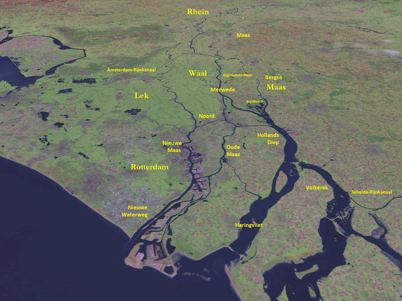
Hollands Diep ( pre-1947 spelling: Hollandsch Diep) is a wide river in the


Netherlands
)
, anthem = ( en, "William of Nassau")
, image_map =
, map_caption =
, subdivision_type = Sovereign state
, subdivision_name = Kingdom of the Netherlands
, established_title = Before independence
, established_date = Spanish Netherl ...
and an estuary
An estuary is a partially enclosed coastal body of brackish water with one or more rivers or streams flowing into it, and with a free connection to the open sea. Estuaries form a transition zone between river environments and maritime environment ...
of the Rhine
), Surselva, Graubünden, Switzerland
, source1_coordinates=
, source1_elevation =
, source2 = Rein Posteriur/Hinterrhein
, source2_location = Paradies Glacier, Graubünden, Switzerland
, source2_coordinates=
, so ...
and Meuse
The Meuse ( , , , ; wa, Moûze ) or Maas ( , ; li, Maos or ) is a major European river, rising in France and flowing through Belgium and the Netherlands before draining into the North Sea from the Rhine–Meuse–Scheldt delta. It has a t ...
rivers. Through the Scheldt-Rhine Canal it connects to the Scheldt
The Scheldt (french: Escaut ; nl, Schelde ) is a river that flows through northern France, western Belgium, and the southwestern part of Netherlands, the Netherlands, with its mouth at the North Sea. Its name is derived from an adjective corr ...
river and Antwerp
Antwerp (; nl, Antwerpen ; french: Anvers ; es, Amberes) is the largest city in Belgium by area at and the capital of Antwerp Province in the Flemish Region. With a population of 520,504,
.
The Bergse Maas river and the Nieuwe Merwede river join near Lage Zwaluwe
Lage Zwaluwe is a village in the municipality Drimmelen, North Brabant, the Netherlands. The Lage Zwaluwe railway station and the Moerdijk bridges lie to the west of the village.
History
The village was first mentioned in as 1291 Zwaluwe, and ...
to form the Hollands Diep. The Dordtsche Kil
The Dordtse Kil ( pre-1947 spelling: Dordtsche Kil) is a short river in South Holland in the Netherlands. The river is tidal and forms the connection between the Oude Maas river and the Hollands Diep. The river is for most part artificial in origi ...
connects to it near Moerdijk
Moerdijk () is a municipality and a town in the South of the Netherlands, in the province of North Brabant.
History
The municipality of Moerdijk was founded in 1997 following the merger of the municipalities of Fijnaart en Heijningen, Klundert ...
. Near Numansdorp it splits into the Haringvliet
The Haringvliet is a large inlet of the North Sea, in the province of South Holland in the Netherlands. It is an important estuary of the Rhine-Meuse delta.
Near Numansdorp, the Hollands Diep splits into the Haringvliet and the Volkerak ...
and the Volkerak
The Volkerak is a body of water in the Netherlands. It is part of the Rhine–Meuse–Scheldt delta, and is situated between the island Goeree-Overflakkee to the north-west and the Dutch mainland to the south and east. The western part of the Volk ...
.
History
The Hollands Diep was formed as a result of the extensive flood of 1216, which breached the dunes of Voorne and created a deep saltwater inlet (the currentHaringvliet
The Haringvliet is a large inlet of the North Sea, in the province of South Holland in the Netherlands. It is an important estuary of the Rhine-Meuse delta.
Near Numansdorp, the Hollands Diep splits into the Haringvliet and the Volkerak ...
). During a second flood, the St. Elizabeth floods, this inlet connected to the Merwede
The Merwede () etymology uncertain, possibly derived from the ancient Dutch language, Dutch ''Merwe'' or ''Merowe'', a word meaning "wide water") is the name of several connected stretches of river in the Netherlands, between the cities of Woudrich ...
and became an important estuary of the Rhine
), Surselva, Graubünden, Switzerland
, source1_coordinates=
, source1_elevation =
, source2 = Rein Posteriur/Hinterrhein
, source2_location = Paradies Glacier, Graubünden, Switzerland
, source2_coordinates=
, so ...
and Meuse
The Meuse ( , , , ; wa, Moûze ) or Maas ( , ; li, Maos or ) is a major European river, rising in France and flowing through Belgium and the Netherlands before draining into the North Sea from the Rhine–Meuse–Scheldt delta. It has a t ...
rivers. From that moment on, the freshwater part of the estuary (east of the Hellegatsplein) was renamed Hollands Diep. The former river Striene De Striene was a water channel that ran between the Schelde near Tholen and the Maas rivers in Zeeland in the Netherlands. In the St. Elizabeth's Flood of 1421 the watercourses in the Maas and Rhine delta were drastically changed, and the Striene ...
, that used to connect the Meuse with the Scheldt
The Scheldt (french: Escaut ; nl, Schelde ) is a river that flows through northern France, western Belgium, and the southwestern part of Netherlands, the Netherlands, with its mouth at the North Sea. Its name is derived from an adjective corr ...
, was completely destroyed by these floods and can no longer be recognised on maps.


River crossings
At this point where the Hollands Diep splits, there is aroad
A road is a linear way for the conveyance of traffic that mostly has an improved surface for use by vehicles (motorized and non-motorized) and pedestrians. Unlike streets, the main function of roads is transportation.
There are many types of ...
traffic node on an artificial island (the Hellegatsplein), connecting to the Hoeksche Waard
The Hoekse Waard (; pre-1947 spelling: Hoeksche Waard) is an island between the Oude Maas, Dordtsche Kil, Hollands Diep, Haringvliet and Spui rivers in the province of South Holland in the Netherlands. The island, part of the namesake munic ...
island on the north by the Haringvliet bridge, to the Goeree-Overflakkee
Goeree-Overflakkee () is the southernmost delta island of the province of South Holland, Netherlands. It is separated from Voorne-Putten and Hoeksche Waard by the Haringvliet, from the mainland of North Brabant by the Volkerak, and from Schouwen ...
on the west by the Hellegatsdam, and to the mainland on the southeast by the Volkerak Sluices.
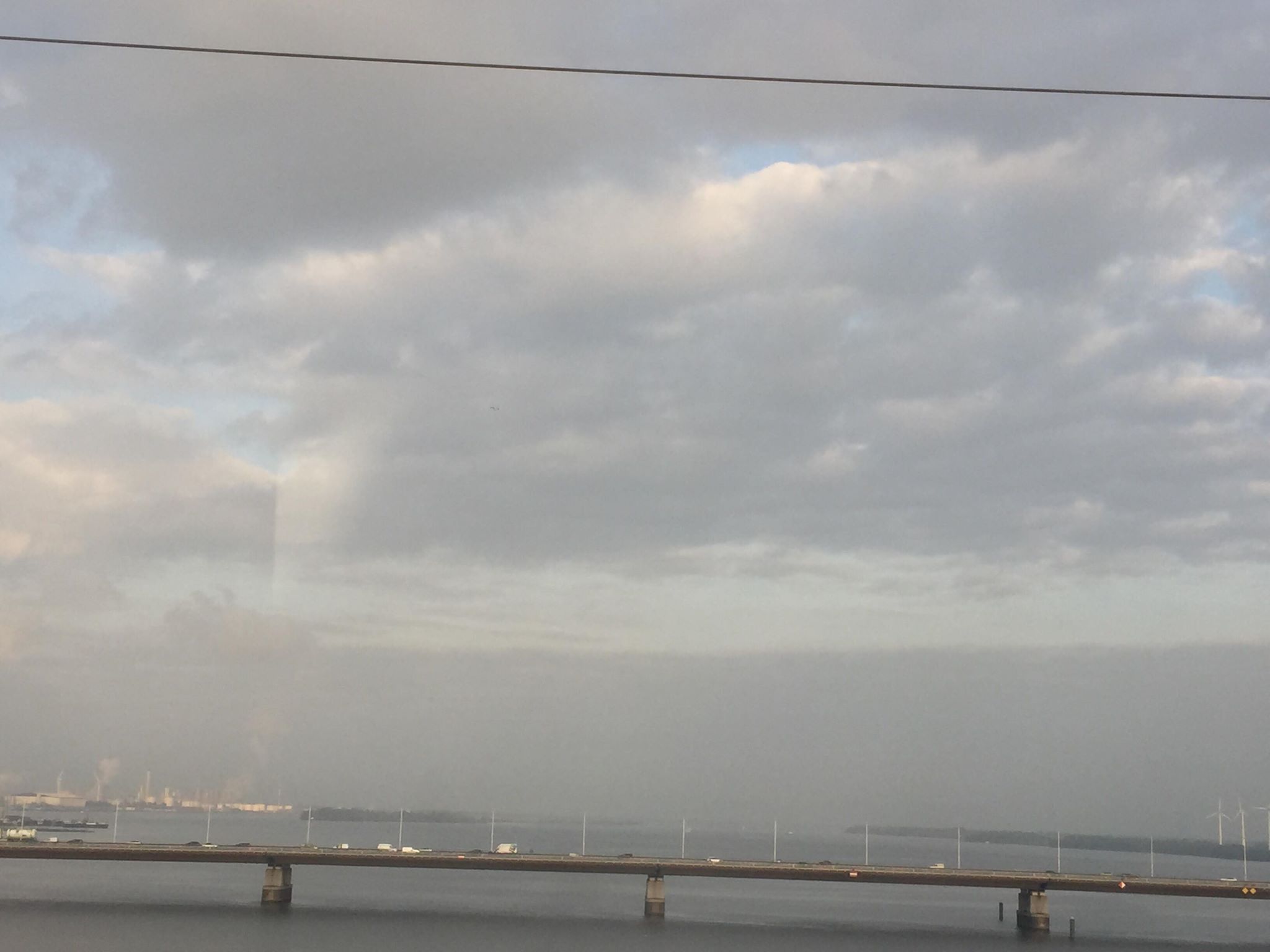
On the east side of the Hollands Diep the Moerdijk bridges
The Moerdijk bridges in the Netherlands are bridges that connect the Island of Dordrecht with the Dutch province of North Brabant (''Noord-Brabant'') across the ''Hollands Diep''. The first bridge was built at the end of the 19th century, and w ...
connect the Dordrecht
Dordrecht (), historically known in English as Dordt (still colloquially used in Dutch, ) or Dort, is a city and municipality in the Western Netherlands, located in the province of South Holland. It is the province's fifth-largest city after R ...
island on the north to the mainland on the south: a road
A road is a linear way for the conveyance of traffic that mostly has an improved surface for use by vehicles (motorized and non-motorized) and pedestrians. Unlike streets, the main function of roads is transportation.
There are many types of ...
bridge
A bridge is a structure built to span a physical obstacle (such as a body of water, valley, road, or rail) without blocking the way underneath. It is constructed for the purpose of providing passage over the obstacle, which is usually somethi ...
, a railroad
Rail transport (also known as train transport) is a means of transport that transfers passengers and goods on wheeled vehicles running on rails, which are incorporated in tracks. In contrast to road transport, where the vehicles run on a pre ...
bridge; a second railroad bridge has recently been constructed for the HSL-Zuid
The HSL-Zuid ( nl, Hogesnelheidslijn Zuid, en, High-speed Line South), is a 125 kilometre-long (78 miles) Dutch high-speed railway line running between the Amsterdam metropolitan area and the Belgian border, with a branch to Breda, North ...
.
References
{{Authority control Estuaries of Europe Rivers of the Rhine–Meuse–Scheldt delta Rivers of the Netherlands Ramsar sites in the Netherlands Rivers of North Brabant Rivers of South Holland Hoeksche Waard Drimmelen Moerdijk